Alerts
ADAM sends email alerts when it detects a significant event in the areas you care about. Alerts are free, open to humanitarian partners, and configured through a short web form reachable from the Live Map.
What you receive
An alert email announces the event with its key figures and points to the same products you find in the Live Map popup: the dashboard image for an earthquake, the wind and rainfall maps with the population table for a tropical storm, the PDF bulletin for a flood. For evolving events, such as a cyclone that is updated at every forecast cycle, subscribers receive follow-up alerts as new products are issued.
Public alerts are also posted on X (Twitter) by @wfp_adam.
How to subscribe
- Open the Live Map and click Subscribe in the header. The ADAM Subscription Form opens in a new tab.
- Fill in the form and submit it. All fields marked with an asterisk are required.
- You will start receiving alerts for the products and areas you selected. There is no confirmation email to click.
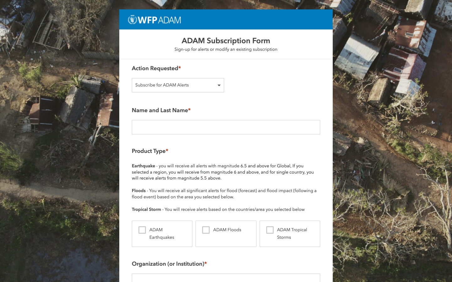
The form asks for:
| Field | What to enter |
|---|---|
| Action Requested | Subscribe for ADAM Alerts, or the option to modify an existing subscription. |
| Name and Last Name | Your name. |
| Product Type | One or more of ADAM Earthquakes, ADAM Floods, ADAM Tropical Storms. |
| Organization (or Institution) | Your agency, NGO, government body or institution. |
| Email Address | Where alerts are sent. An organisational address is preferred over a personal one. |
| Duty Station | Your Regional Bureau, Country Office or city. |
| Functional Area | Your function, from the list. |
| Area of Interest | Global Coverage, one or more WFP Regional Bureaux (Cairo RBC, Bangkok RBB, Johannesburg RBJ, Dakar RBD, Panama RBP, Nairobi RBN), or individual countries. Multiple selection is allowed. |
Triggers by product
The area of interest does more than filter by geography: for earthquakes it also sets the magnitude threshold, so that a global subscription is not flooded by moderate events.
| Product | Trigger |
|---|---|
 Earthquakes | Global coverage: magnitude 6.5 and above. A Regional Bureau: magnitude 6.0 and above. A single country: magnitude 5.5 and above. |
 Floods | All significant flood forecast alerts and flood impact analyses for the selected areas. |
 Tropical Storms | Alerts for storms affecting the selected countries or areas, updated with each new forecast. |
Match the threshold to your role
A Country Office usually wants its own country with the lower earthquake threshold, plus the Regional Bureau for context. A global desk is better served by Global Coverage and the higher threshold.
Managing your subscription
- Change products or areas: submit the form again with the modify action and your registered email address.
- Stop receiving alerts or report a delivery problem: write to hq.geospatial@wfp.org, the ADAM team mailbox printed on every dashboard.
Next steps
- Live Map to see the events that generate alerts
- Event dashboards and products to read what an alert links to
- Hazards for how each module detects and processes events